 Göreme City Guide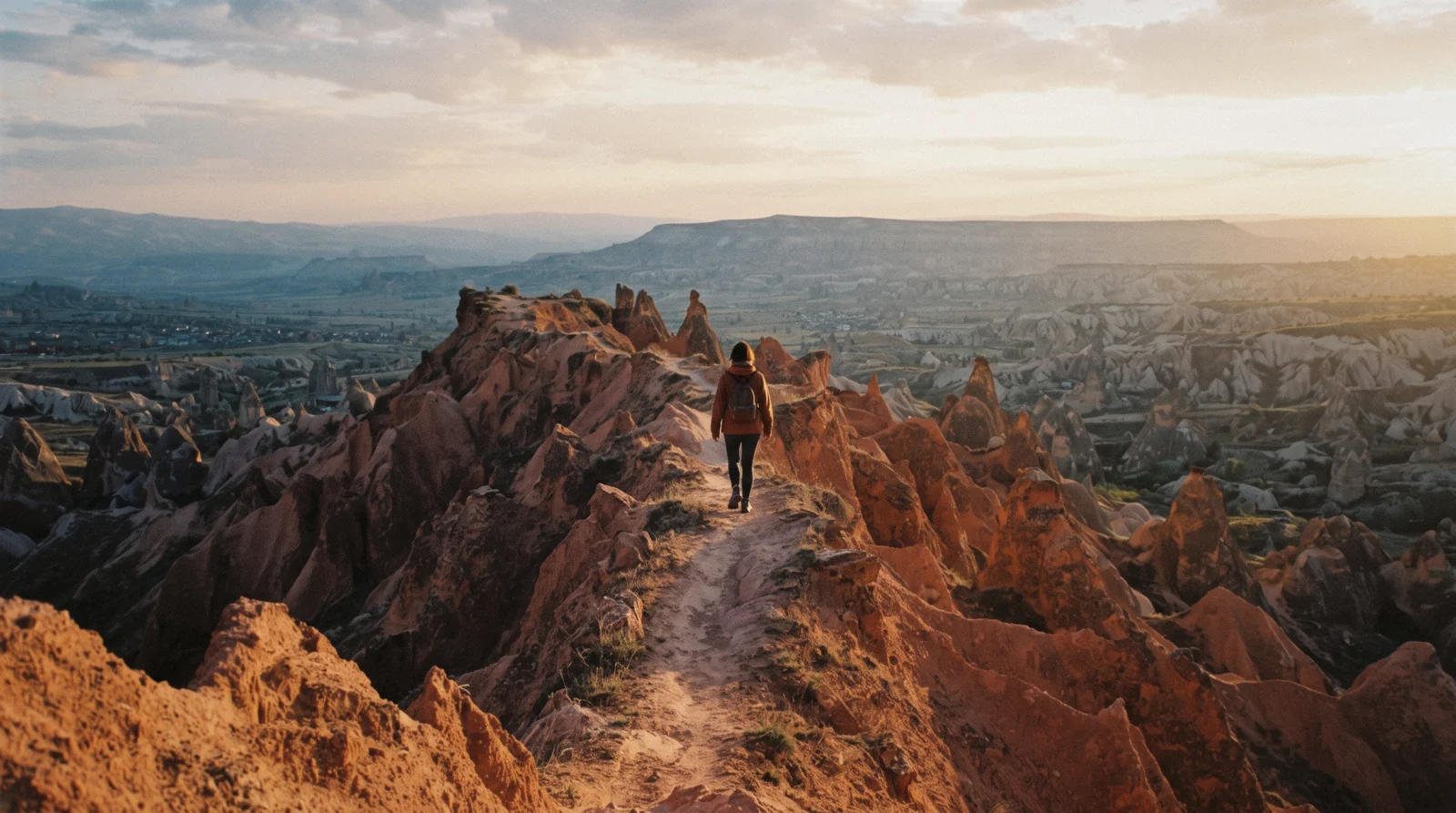
Red Valley Cappadocia
Red Valley, Cappadocia's sunset valley, is known in Turkish as Kızılçukur and sits inside Göreme Historical National Park in Nevşehir Province. Its cliffs are banded in red, orange, pink and white, and sunset is the reason most people come. The valley is free and ungated, with no ticket booth and no published hours. If you are building a wider plan, see the full Göreme list.
Quick answer Free to enter, Kızılçukur, sunset hike, arrive 45-60 min before sundown
Red Valley (Kızılçukur) is a free amphitheatre of red-banded rock in Göreme Historical National Park. Its trail runs about 5.0 km with 213 m of climb, graded moderate. Sunset is when the cliffs perform.
Key takeaways
- You can start from either the Çavuşin trailhead or the terrace road car park. Details in the access section.
- The time you should be on the ridge changes a lot through the year. Month-by-month times are in the sunset table.
- If you would rather ride, the horseback ride and the jeep safari run the valleys at golden hour.
Key facts
Opening hours
| All year, every day | Open access year-round, no gate, no hours published |
|---|
Closed None
Planning it
- Time needed
- No official figure. Our routing: 2-3 h for the trail with the viewpoint, 30-45 min for a car-park-to-terrace stop
- Address
- Red Valley (Kızılçukur Vadisi), Göreme Historical National Park, Nevşehir Province, Türkiye The GPS pin is our estimate from the map, no official coordinate is published for the spot.
Nothing here is ticketed. The official park page publishes no fee and no hours for any valley, so every way in on foot or by car costs nothing. The table compares the free ways in against the two rides that bring people to these cliffs without the kilometres of walking. Prices are the platform's own, checked in Q3 2026.
Do you want to earn the amphitheatre on foot, or be parked in front of it when the light hits?
| Way in | Price | What you get | Cancel | Book |
|---|---|---|---|---|
| On foot, full trailWalkers with half a day who want the whole valley experience | Free | The 5.0 km of banded cliffs, gullies and tunnels with the viewpoint finish | — | Official site |
| By car to the terrace roadDrivers, families and anyone short on time who still wants the sunset | Free | The sunset-terrace car park and the short climb to the best seats | — | Official site |
| Horseback ride at sunrise or sunsetRiders and couples who want the valleys at golden hour without the hiking | From $5.72 | 1-2.5 h in the saddle with hotel transfers | Per platform policy | Check Availability |
| 2-hour jeep safari at sunrise or sunsetAnyone who wants the views fast, including visitors with limited mobility | From $9.16 | Open 4x4 through the valleys with camera stops | Per platform policy | Check Availability |
Rides to the red cliffs
Two of these rides take the valleys at sunrise or sunset, which is exactly when Kızılçukur shows its colour. The ATV convoy runs the same ground for speed instead. Prices and ratings are the operators' own listings.
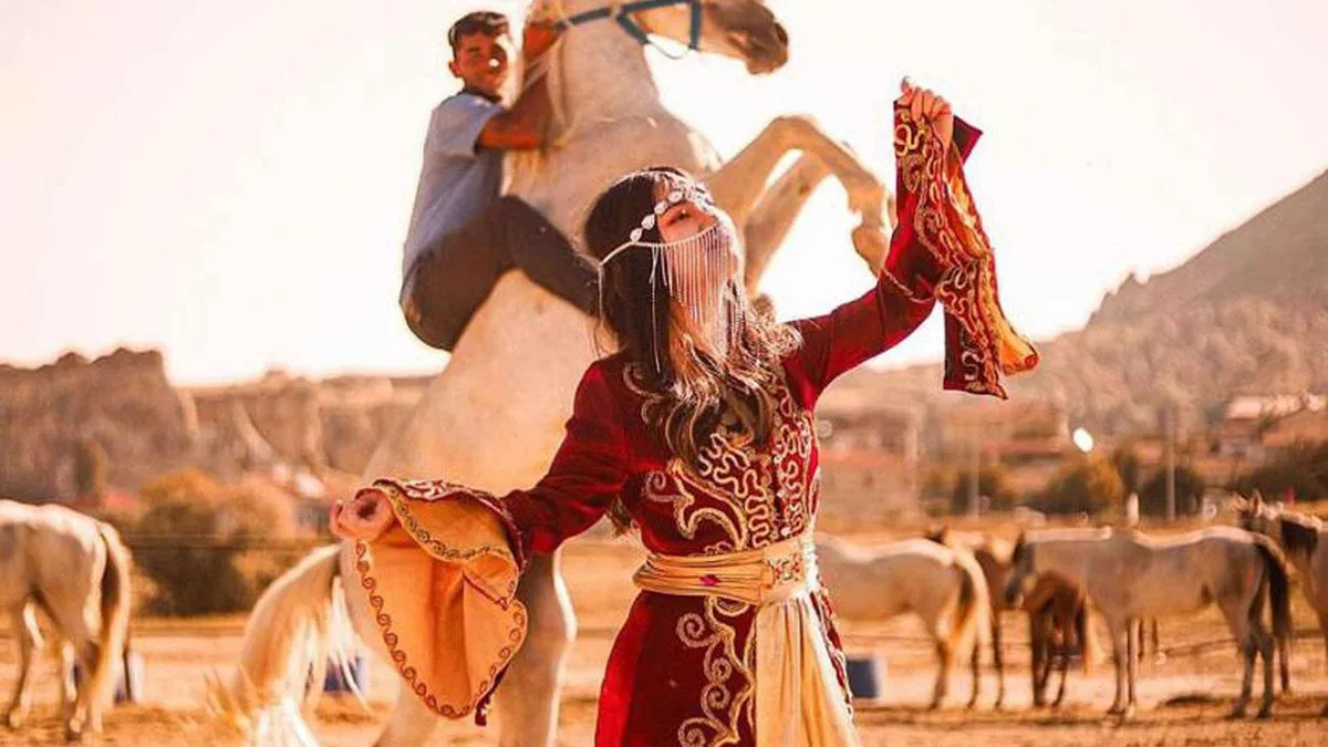 from $5.72
Cappadocia: Horseback Tour with Sunrise and Sunset Options
The ranch country version of sunset: an hour or two on calm horses through Love Valley's columns, sunrise or sunset slots, transfers included.
Check Availability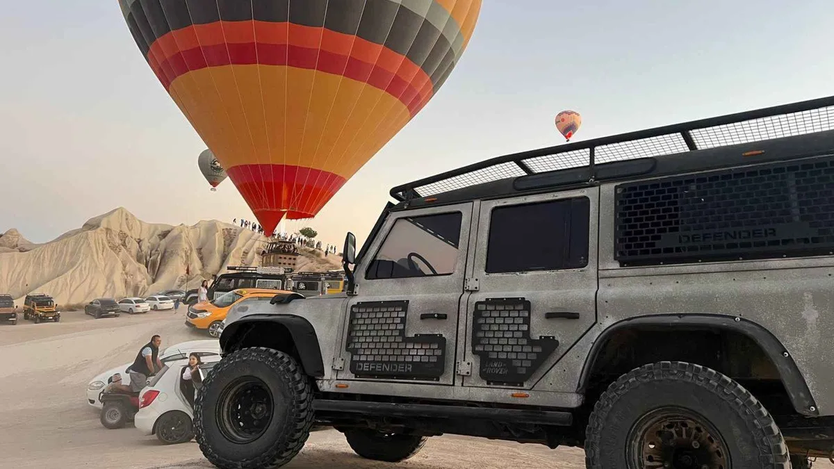 from $9.16
Cappadocia: 2-Hour Jeep Safari at Sunrise & Sunset Views 4x4
A two-hour open-jeep loop through the valleys at sunrise or sunset, camera-friendly stops built in, pickup from your hotel.
Check Availability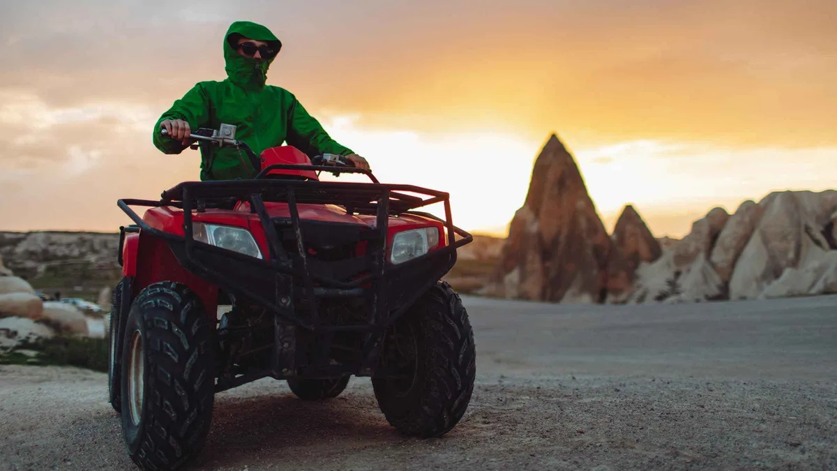 from $29.57
Cappadocia:Göreme ATV Sunset or Daytime Tour
Two hours of dust and valleys to Rose Valley or Sword Valley at sunset, with a guide leading the convoy. No licence needed, big grins standard.
Check AvailabilityPrices, ratings and details are the platform's own. dollar figures are the listed prices — the platform bills in your account's currency.
What Red Valley is
Before the logistics, it helps to know what kind of place this is and why the light matters so much here.
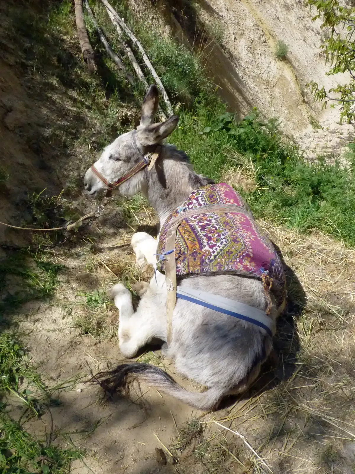
Photo: Ji-Elle, CC BY-SA 3.0, via Wikimedia Commons
Kızılçukur, the red hollow
The Turkish name Kızılçukur translates roughly as the red hollow, and it does exactly what it says on the sign. The cliffs here are streaked in wide bands of red, orange, pink and white. The colour comes from iron in the volcanic rock, and it reads most strongly the moment the light rakes across the walls at a low angle.
At midday the bands are simply rock. In the last hour of daylight they turn into the reason people make the trip.
A valley inside a national park
Kızılçukur sits inside Göreme Historical National Park, protected as a national park since 1986 and inscribed by UNESCO together with the Rock Sites of Cappadocia in 1985. There is no gate, warden or ticket check on any trail, and access is open at all hours. The valley floor still carries vineyards and old farming terraces that people work to this day, which is one of the quieter pleasures of the walk.
Read more in our Göreme National Park guide.
Why sunset is the event
The national park trails page calls sunset especially spectacular in this valley, and the shape of the place is why. The cliffs form an amphitheatre rather than a slope, so the walls catch and hold the light like a room. As the sun drops the rock glows in waves, first pink and orange, then deep red.
If you want a version of the evening without any walking, Göreme Sunset Point is the in-town alternative. Rose Valley is the immediate neighbour and shares the same light.
Walking Red Valley
The trail is the best way into the valley, and it is gentler than the views suggest. Here is what the numbers say and how it feels on the ground.
The figures, and what they feel like
The national park trails page puts the Red Valley Trail at approximately 5.0 km with roughly 213 m of climb, graded moderate. No official time figure is published for it. Our routing gives 2 to 3 hours with the viewpoint included.
In practice the route threads narrow gullies and short tunnels, passing cave churches and abandoned dwellings cut into the soft rock. It connects with Rose Valley, so the two combine into one longer hike if you have the legs for it.
The Rose-Red loop
The most satisfying way to walk it is the Rose-Red loop, about 5 km starting at the Çavuşin trailhead. It runs through Rose Valley and finishes at the viewpoint just as the cliffs light up. At a relaxed pace count on 2 to 3 hours.
Time your start so you reach the viewpoint in the last hour of daylight, which changes a lot through the year, so check the sunset table below. More routes are in our Cappadocia valley walks guide.
The table compares the three realistic ways to see the valley, from a 30-minute car-park stop to a half-day circuit. The times are our routing, since no official duration is published for any of them.
| Route | Time | Effort | Who it suits |
|---|---|---|---|
| Car park to the terrace and back | 30-45 min | Easiest | Sunset without the hike |
| Rose-Red loop from Çavuşin | 2-3 h | Moderate | Walkers who want both valleys |
| Full trail plus the flag hill | Half a day | Moderate to demanding | Photographers and careful walkers |
The narrow bits, honestly
Parts of the rock here are steep and crumbly, and the descent in fading light is the moment to slow down. No official hiking warning exists for this valley or for any other Cappadocia valley, so the caution in this paragraph is practical advice drawn from hiking sources rather than an official notice. If the path underfoot feels wrong, the road walk back to the car park takes about 20 minutes and is the sensible bail-out.
Good shoes and a torch in the bag fix most of the risk.
Where to start: the two access points
There are two ways into the valley, and they give you two very different visits.
The Çavuşin side
The walking route into the valley starts at the village trailhead of Çavuşin on the Avanos road. This is the full valley experience, taking you through Güllüdere with its gullies, tunnels and rock-cut churches before the climb to the viewpoint. See our Çavuşin guide for the village itself.
Our routing allows a road walk from Göreme for anyone without a car, which adds distance but no difficulty.
The terrace road
The sunset viewpoint sits above the Kızılçukur side, at the end of a road from Göreme with a car park where the road stops. This is the shortcut that turns a hike into a viewing trip. A short climb from the parking takes you to the best seats on the terrace.
Vans and taxis run out here in season, so you do not strictly need your own wheels. No official parking fee is published.
The flag hill, the quiet version
Behind the terrace cafes a hill rises, topped with a flag, and a steep path of about 15 minutes leads up it. From the top you look down over Red Valley and Rose Valley and across to Uçhisar on the horizon. You get the same light as the crowds below, on a fraction of the crowd.
This is our routing for anyone who values calm over convenience.
Sunset on the ridge, month by month
The exact minute the sun drops changes by almost three hours between winter and summer. The times below come from the sunrise-sunset.org tables for Göreme's coordinates, rounded to the nearest five minutes. Türkiye stays on UTC+3 all year, so the sunset hour shifts with the seasons and not with the clock.
The last column is the window we recommend for being on the ridge, 45 to 60 minutes before the mid-month sunset. Round the figures to the 1st of each month using the second column.
| Month | Sunset, about the 1st | Sunset, about the 15th | Be on the ridge by |
|---|---|---|---|
| January | 17:30 | 17:45 | 16:45 |
| February | 18:05 | 18:20 | 17:20 |
| March | 18:35 | 18:50 | 17:50 |
| April | 19:05 | 19:20 | 18:20 |
| May | 19:35 | 19:45 | 18:45 |
| June | 20:00 | 20:10 | 19:10 |
| July | 20:10 | 20:05 | 19:05 |
| August | 19:55 | 19:35 | 18:35 |
| September | 19:15 | 18:50 | 17:50 |
| October | 18:25 | 18:05 | 17:05 |
| November | 17:40 | 17:30 | 16:30 |
| December | 17:20 | 17:20 | 16:20 |
The crowd, and what to do about it
The terrace fills from well before sunset in season, and coach tours land in the same window. Arrive early or take the flag hill if you want space. Stay 20 minutes after the sun goes, because the colour keeps changing after sunset and half the crowd leaves immediately.
That post-sunset half hour is often the best photography of the evening, and it costs you nothing but patience.
Photography notes
The valley photographs differently at every hour, and the difference between a good frame and a flat one is mostly the clock.
The light, hour by hour
At midday the banded cliffs are simply geology, and the wide shots look like everyone else's. The colour engine starts when the sun drops toward the ridge and the light rakes across the bands, which is why every photographer on the terrace is there two hours before the sky does anything dramatic. Work the sequence backwards: shoot the wide amphitheatre first while the light is still even, then tighten on the bands as the contrast builds, and save the last frames for the twenty minutes after sunset, when the red goes almost purple and the terraces below switch on their lights.
After that the blue half hour carries the town lights in the distance and the crowd thins by half.
Positions
The terrace rail is the classic frame, and the flag hill above it trades convenience for height, with Red Valley, Rose Valley and the Uçhisar horizon in one composition. Down inside the valley the gullies and tunnels compress the colour into frames no viewpoint can give, at the cost of shooting on uneven ground in a slot of sky. Drones are the question every photographer asks: drones of 500 g or more must be registered with the civil aviation authority and flights outside the green zones need permission, and no blanket Cappadocia carving exists, so check the rules before you fly one here rather than after.
Water, signal and the walk down
The valley is wild in the ways that matter. Here is what to carry and what to expect from the seasons.
What is not there
There are no facilities at the trailheads or on the terrace, beyond a few cafes at the car park in season. Bring water and sun protection, and download your route before the signal drops, because phone signal can be patchy inside the deeper canyons. The national emergency number in Türkiye is 112.
No official hours or warnings exist for this valley, so self-sufficiency is the working assumption.
Winter and summer
Göreme's average July high is about 30°C measured over thirty years, so midday walking is the hour to avoid in summer. Go early or late and carry more water than feels necessary. Winter highs sit under 8°C with hard frosts at night, which means the crumbly descents can be icy early in the day.
Layer up, watch the sky, and give icy sections a wide berth or use the road instead.
Red Valley on the map
The valley sits a short drive west of Göreme, with Rose Valley on its flank and Uçhisar on the horizon.
Pair it with
Walking times are our estimates from the map, measured from the valley.
Rose Valley
The two valleys connect, and the Rose-Red loop walks both in one 2-3 hour outing that finishes at the viewpoint.
15 min between the valleys Read the guideÇavuşin
The village holds the trailhead for the full walk through Güllüdere, and it makes a natural base for the walk before you set off.
25 min to the village trailhead Read the guideGöreme Sunset Point
The in-town version of the evening, with the same golden light and no trail shoes required.
40 min back toward town Read the guideHow much time to give Red Valley
The honest answer depends on which of the three evenings you are having. The table routes the two common time budgets and the photographers' version, and the times are our routing because no official duration is published.
| Time you have | The routing | What to drop |
|---|---|---|
| One evening, about 2 h | Drive or taxi the terrace road, take the short climb to the ridge, stay through civil twilight, road back | The trail, the churches, the flag hill |
| An afternoon, 3-4 h | Rose-Red loop from the Çavuşin trailhead timed to reach the viewpoint in the last hour of light | The flag hill detour and any slow church stops |
| A full valley day | Both valleys with the churches, the flag hill at the end, out and back by road on foot | Nothing, this is the full version, start early |
Two rules hold across all three. First, the walk shrinks from the middle: cut the distance before you cut the daylight margin, because the crumbly descents are what turn dangerous after dark. Second, the hour on the ridge is the part people remember, so when time gets short, protect the sunset window rather than the kilometres.
A short visit that ends with the amphitheatre glowing beats a long walk that finishes in the dark. When the valley day is planned, the rest of the town page by page sits in our Göreme guide.
Red Valley questions
Is Red Valley free?
Yes. There is no entrance fee and no ticket exists for the valley. The park publishes no fee for any of its valleys, and the only spend is a tour or ride if you choose one.
Why is it called Red Valley?
The Turkish name Kızılçukur means roughly the red hollow. The cliffs carry wide bands of red, orange, pink and white, and the red comes from iron in the volcanic rock. The colour is strongest when the sun sits low.
How long is the Red Valley hike?
The trail runs about 5.0 km with roughly 213 m of climb, graded moderate on the national park trails page. No official duration is published. Our routing allows 2 to 3 hours with the viewpoint included.
Where do you start the Red Valley hike?
Two starting points work. The Çavuşin village trailhead gives the full walk through the valley, and the terrace road from Göreme has a car park that puts you minutes from the viewpoint. See the access section above for both.
Is Red Valley good for sunset?
It is the valley for it. The park's own trails page calls sunset especially spectacular here, and the amphitheatre shape holds the light on the red bands. Aim to be on the ridge 45 to 60 minutes before the sun goes down. If you would rather watch from the saddle, the horseback ride runs at sunset with transfers included.
Is the Red Valley hike dangerous?
It needs care rather than courage. Some sections are steep and crumbly underfoot, and no official hiking warning exists for the valley. Slow down on the descent, wear proper shoes, and if the path feels wrong the road back to the car park takes about 20 minutes. Our Cappadocia valley walks guide covers preparation, and Rose Valley next door is a gentler warm-up.
Five things most visitors do not know
The trail has no official name on the ground, and the national park page is the only body that prints a length or a grade for it [national-parks.org trails page].
The park publishes no fee and no hours for any valley, so every trailhead is free and open at all times [national-parks.org Göreme page].
No official hiking warning exists for the crumbly sections. The caution you read about steep rock and maze-like junctions comes from hiking sources, not from any authority [our facts file, facts-pack-2].
The valley combines with Rose into one loop, and the trails page says so in a single line [national-parks.org trails page].
The clocks never move here. Türkiye stays on UTC+3 all year, so the sunset hour shifts with the seasons and not with the clock [sunrise-sunset.org tables for Göreme].
The valley on video
These clips cover the wider valley system around Göreme rather than Kızılçukur alone. Watch them for a feel of the terrain, the gullies and the light before you set out.
Six magical hikes in Cappadocia
A roundup of six valley walks around Göreme, useful for seeing how the trail systems connect.
Video: World Wild HeartsHiking Love Valley and White Valley
A walk through the Love to White valley continuation on the ridge system north of these trails.
Video: Globetrotting ToreGetting lost on the valley trails
An honest account of how easy it is to lose the way on Cappadocia's unsigned paths, which is exactly why you download a route.
Video: Kinetic PassportsThird-party videos, embedded without cookies. Neither the channels nor the videos are connected to this site.
Prices, hours and terms are set by the venue or operator and confirmed at checkout.
We may earn a commission if you book through one of our links, at no extra cost to you. Full affiliate disclosure