 Göreme City Guide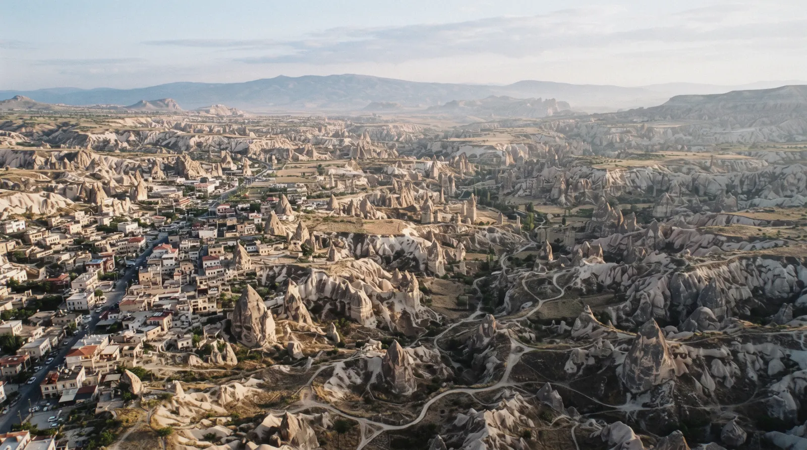
Göreme Map: 19 Pinned Places, Prices and Drive Times
This Göreme map carries 19 pins in three colours. Madder red marks the six ticketed sites, tuff green the six free valleys and viewpoints, and ink the seven villages and towns. Every pin links to its own page on this site and to Google Maps, so a price on a pin is one tap from a full guide. The same pins repeat as a text list under the map, because a list can be read and compared and a pin cannot. Prices on the red pins are the Ministry's foreign-visitor euro fares converted at the site's fixed rate. Use the map to place the sights, then work through the things to do behind them in and around Göreme.
Quick answer What is on the map, what the colours mean, and what it does not pin
The 19 pins split into 6 ticketed sites, 6 free valleys and viewpoints, and 7 villages and towns. Göreme sits inside the northern cluster at 1,104 m, where nearly everything worth a morning is a walk from town. The underground cities and the Ihlara gorge stand apart, Derinkuyu about 45 minutes away by road and Ihlara well beyond it, which is why this map works best as one walkable base plus two planned drive days.
Key takeaways
- Red pins are ticketed, six of them, from $6.88 (€6) to $22.93 (€20) at the gate, and the $74.51 (€65) MuseumPass covers all six for three days. It earns its keep from the fifth distinct ticket onward. The sums sit on the museum pass page.
- Green pins are free valleys and viewpoints, walkable from town, starting with Love Valley.
- Ink pins are the villages, reached on the hourly dolmuş that runs Ürgüp–Göreme–Paşabağ–Avanos 07:30–20:00, with fares unpublished. The practical detail sits in getting around.
- To cover the ticketed pins without driving, the combined red and green day tour rides the loop for you, and the shortlist on this page picks the five pins worth the time.
The Map: 19 Pins, Three Colours
Filter the numbered pins with the colour chips above the map. The text list under the map is the same set grouped the same way, and every entry links to its page here and to Google Maps. Tap a pin for the price and a booking link where one exists.
Ticketed sites 6 pins
- Göreme Open Air Museum$22.93 (€20)Check AvailabilityThe headline sight, a monastic cluster of rock churches inscribed by UNESCO in 1985, fifteen minutes' walk from town. Open daily to 18:45 with no weekly closing day, and the finest frescoes inside cost a second ticket.
- Zelve–Paşabağ$13.76 (€12)Check AvailabilityPaşabağ's mushroom-headed cones, with the three abandoned valleys of Zelve 2 km up the road on the same ticket. One ticket covers both, and both run to 20:00, the latest gate time in the northern cluster.
- Derinkuyu Underground City$14.90 (€13)Check AvailabilityThe deepest open underground city, about 45 minutes by road from Göreme. Sixty to seventy-five minutes in narrow one-way tunnels decides it for anyone claustrophobic.
- Kaymaklı Underground City$14.90 (€13)Four of eight levels open, wider passages than Derinkuyu, and the region's longest ticket-office hours to 20:00. The calmer of the two underground visits.
- Ihlara Valley main gate$17.19 (€15)Check AvailabilityA river gorge with rock-cut churches, 382 steps down from the gate and a 4 km riverside walk to Belisırma. The ticket includes the Selime monastery entrance at the far end of the gorge.
- Selime MonasteryThe cathedral-sized rock monastery cut into a volcanic massif at the north end of the Ihlara gorge. It has no ticket of its own, the Ihlara ticket and the museum pass both cover it.
Valleys and viewpoints 6 pins
- Love ValleyFreeThe region's famous pillar valley, walkable to from Göreme, about 3 km or 40 to 50 minutes each way. Open landscape, no gate and no ticket, and best early before the quad-bike traffic arrives.
- Pigeon Valley trailheadFreeA point on the one-way valley path between Göreme and Uçhisar, 4.0 km in all. Most walkers take it downhill from Uçhisar to Göreme, then ride the dolmuş back.
- Rose ValleyFreeThe orchard valley between Göreme and Çavuşin that the 5 km Rose–Red loop threads through. No ticket and no official trail registry, so the junctions are unsigned and a downloaded map earns its keep.
- Red Valley (Kızılçukur)FreeThe rose-coloured amphitheatre at the region's western edge and the best of the free sunset stands. The light is the reason tour jeeps time their evening run to it.
- Devrent ValleyFreeThe animal-shaped cones of the so-called imagination valley between Paşabağ and Avanos. No Ministry ticket exists for it, so it costs nothing, and 20 to 30 minutes covers the flat main path.
- Göreme Sunset PointFreeThe ridge above town where the balloons land and half the town climbs to watch the light go. A ten-minute walk from the centre and free at any hour.
Villages and towns 7 pins
- Göreme town centreThe base town at 1,104 m and the practical centre of this map: the otogar, the tour desks and the dolmuş stop for Ürgüp, Paşabağ and Avanos all sit within a few minutes' walk.
- Uçhisar CastleThe tallest rock pile in Cappadocia and the vantage that orients every other pin here. No official price or hours exist in any Ministry system, so treat the on-site signs as the only authority.
- ÇavuşinThe old Greek village under a broken castle ridge on the Göreme–Avanos road. The great rock church above the houses is closed for restoration, which leaves the lanes and facades as the sight.
- AvanosThe pottery town on the Kızılırmak and the northern terminus of the one published dolmuş line. Pairs naturally with Paşabağ and Devrent on the same half-day loop.
- ÜrgüpThe district capital and wine town where the dolmuş line starts its hourly run at 07:30. The Three Beauties cones stand on the road in from the south.
- OrtahisarThe castle village ten minutes by road from either Ürgüp or Göreme, with lemon storerooms cut into the rock. The quietest of the six villages on this map.
- MustafapaşaThe former Greek merchant town of Sinasos, 6 km south of Ürgüp, with carved mansion facades and working churches. No ticket gates the lanes.
Pin coordinates come from each place's own published point where one exists. The six ticketed-site pins follow the Ministry's own e-ticket map links, the town and castle pins follow their Wikidata records, and the valley trailheads come from this guide's own walking pages because the valleys carry no entry in any coordinate registry. Where a price is empty the place publishes none, and the page behind the pin explains what to do instead. The euro prices shown are the Ministry's foreign-visitor fares from its official e-shop converted at the rate this site fixes site-wide.
The Five Pins Worth A Short Visit
These are the pins to build a short visit around, chosen for what each gives per hour spent. The times are the routings used across this guide, not official figures, because the Ministry states no visit duration for any site.
| Pin | What it is | Why this one | Time to allow |
|---|---|---|---|
| Göreme Open Air Museum | The UNESCO rock-church cluster at Göreme's edge | The densest collection of frescoed churches in the region and the sight every other pin is measured against | Half a day with the Dark Church, 90 minutes without |
| Göreme Sunset Point | The town ridge above the museum road | Free, ten minutes from the square, and the one place the balloons, the castle and the valley light line up in one frame | 45 minutes at the end of a day |
| Love Valley | Pillar valley walkable from town | No ticket, no gate, and the closest the map comes to its scenery on foot | Two to three hours on the valley floor, 40 minutes to the viewpoint |
| Zelve–Paşabağ | Mushroom cones plus three abandoned valleys | One ticket covers both, and the 20:00 close makes it the site that forgives a late start | 40 to 50 minutes at Paşabağ, half a day with Zelve |
| Uçhisar Castle | The tallest rock pile in the region | The climb that orients every other pin, and the village around it is the calmest café stop on the map | An hour for castle and village |
The Ministry publishes no visit duration for any of the six ticketed sites, so every time in the last column is this guide's own routing, the same figures the linked pages carry.
The Cards That Cover This Map
Two formats take in the widest set of pins on this map. One is the combined day loop by coach, the other a private car with a licensed guide. Shared-coach prices do not include the museum tickets, so entry is paid separately at the gates marked here.
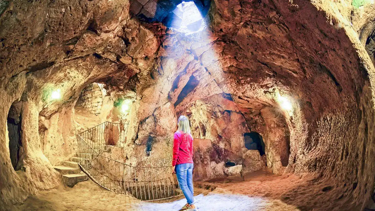 from $21.07
Full Day Cappadocia Red and Green Combined Day Tour
The whole classic loop in one day: the north valleys, the Open Air Museum side, then the underground city and Ihlara on the green half. Entry tickets are extra.
Check Availability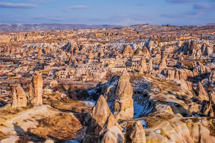 from $211.65
Full-Day Private Cappadocia Tour with Car and Licensed Guide
Your own car and licensed guide for a day, routed to your interests, with the pickup from your Göreme door. Entries and lunch are extra.
Check AvailabilityPrices, ratings and details are the platform's own. dollar figures are the listed prices — the platform bills in your account's currency.
What The Three Colours Mean
The colour of a pin tells you what kind of decision it asks of you.
Madder red, ticketed sites. Six pins where somebody sells a ticket. All six prices are printed at the gate, dollar first with the euro figure the Ministry actually charges foreign visitors, and no site among them closes a day each week. The $74.51 (€65) MuseumPass Cappadocia e-card covers all six for three days from first use, one entry each.
The same six tickets bought separately come to $90.60 (€79), so the full circuit saves $16.05 (€14), and the pass pays for itself from the fifth distinct ticket onward. The ticket-by-ticket arithmetic lives in the tickets hub.
Tuff green, valleys and viewpoints. Six pins that cost nothing because no gate exists. These are the pins you walk to: Love Valley 3 km out of town, Pigeon Valley's one-way 4 km path, the Rose–Red loop, Red Valley's sunset amphitheatre, Devrent's animal shapes and Sunset Point on the ridge above Göreme. Open landscape means unsigned junctions and no facilities, so drinking water goes in the bag before you set out and a downloaded map does the wayfinding the terrain will not.
Route notes for all six are on the valley walks page.
Ink, villages and towns. Seven pins where people live, only one of which, Göreme itself, doubles as a base. The dolmuş line stitches Ürgüp, Göreme, Paşabağ and Avanos together on an hourly run, which makes those four easy without a car. The villages off that line, Ortahisar, Mustafapaşa, Çavuşin and Uçhisar, want a car or a taxi, though Çavuşin and Uçhisar sit close enough to fold into a valley walk.
Compare the endpoints in Ürgüp and Avanos before fixing a base.
How The Region Is Shaped, And Why The Pins Cluster
The pins fall into three geographical groups, and knowing them saves a day of wasted driving.
The northern cluster. Göreme sits inside one valley system, and the Open Air Museum, Love, Pigeon, Rose and Red Valleys, Sunset Point and Çavuşin all fall within about 3 km of the centre. Uçhisar and its castle close the loop to the southwest, reachable on foot through Pigeon Valley. This is why the first-time map of a Cappadocia trip barely needs a vehicle, and why every hotel in town markets the same walks.
UNESCO inscribed the whole park in 1985. The legal and landscape background is on the national park page. Sunset Point and the Pigeon Valley path close that loop on foot, which is why the evening walk and the morning museum so often share one day.
The underground southwest. Derinkuyu and Kaymaklı sit 40 to 50 minutes' drive southwest toward Niğde, two towns whose cities beneath them were cut as one refuge system, linked by 8–9 km of tunnels that neither site lets you walk. Both charge the same $14.90 (€13) ticket and both show you the same idea at different depths, Derinkuyu deeper and narrower, Kaymaklı wider and calmer. Pick one unless you are obsessed, and spend the saved hours on a green pin.
The north and east beyond the park. Paşabağ, Devrent and Avanos line the Göreme–Avanos road and pair naturally into one half-day run, while Ürgüp, Ortahisar and Mustafapaşa sit to the east. Paşabağ and Zelve share one ticket and stand 2 km apart, so they are always a single stop. Mustafapaşa is the quietest of the set, a former merchant town with carved facades and no ticket gates.
Ortahisar makes the easiest extra stop between Göreme and Ürgüp. Read more on Ortahisar and Mustafapaşa.
What No Road On This Map Does Well
The map looks compact, but the road network turns two of its pins into most of a day.
Drive-time reality. The map's two southern pins cost most of a day. The guided green loop that covers Derinkuyu, Ihlara and Selime lists nine to nine and a half hours door to door, and a private car with a guide runs about eight. From Göreme, Derinkuyu is about 45 minutes by road, and the Ihlara gate lies far beyond it.
Plan the southern pins as their own day and keep the northern cluster for the days without a vehicle. Worked itineraries are on the day trips page.
No train exists. This is a verified negative, not a gap in the research: there is no passenger rail to Nevşehir or Göreme. The nearest mainline station is Kayseri, about 75 km away, so rail-and-bus combinations mean a long road leg either way. Most visitors fly instead, into Nevşehir (NAV) around 40 minutes from Göreme or into Kayseri (ASR), 75 km or one hour to one hour twenty by road.
The airport comparison is worked through in getting to Göreme. The distances behind those times, and the two tour formats that absorb them, are set out below.
| Leg or format | The figure | Where it is stated |
|---|---|---|
| Göreme to Derinkuyu by road | About 45 minutes | The Derinkuyu page |
| Göreme to Nevşehir airport (NAV) | About 40 minutes | Getting to Göreme |
| Göreme to Kayseri airport (ASR) | 75 km, 1 h to 1 h 20 | Getting to Göreme |
| Guided green loop with Derinkuyu, Ihlara and Selime | 9 to 9.5 hours door to door | The platforms' tour listings |
| Private car and licensed guide, full day | About 8 hours | The platforms' tour listings |
| Dolmuş Ürgüp–Göreme–Paşabağ–Avanos | Hourly, 07:30 to 20:00, fares unpublished | The operator's own schedule |
The dolmuş reality. Exactly one published line serves this map, running Ürgüp–Göreme–Paşabağ–Avanos, hourly from 07:30 to 20:00, with fares unpublished anywhere official. That single line covers four ink pins and puts Paşabağ within independent reach. Everything else on the map, the underground cities, Ihlara, Uçhisar, Ortahisar and Mustafapaşa, is a tour seat, a taxi or your own rental.
Fares for the line itself are unpublished, and what the whole day does cost, taxis, rentals and entries included, is worked out on the costs page. The timetable still shapes the itinerary more than any distance does.
The Gaps On This Map, And Why Each One Is A Finding
What the map leaves off is as deliberate as what it pins, and each omission has a reason you can check.
- No pin for the Dark Church. It stands inside the Open Air Museum ticket line and the Ministry publishes one point for both, so the museum pin carries it. It charges a separate ticket, $6.88 (€6) at the same gate, and the Ministry's own map point for it sits about 3 km from the real church. (Ministry e-shop and fee list) - No pin for the balloon launch fields. The balloons lift from valley-floor sites that move with the wind and are assigned by the authority's slot system, so no fixed coordinate exists to pin honestly. (SHGM's published slot rules for balloon areas) - No price on the castle pin. Uçhisar Castle appears in no Ministry fee list, no e-shop catalogue and no published hours. The finding is printed on the pin instead of an invented number. (absent from the Ministry fee list and e-shop catalogue) - No hotel pins. The base town has hundreds of cave rooms and this guide ranks none of them from a map. Where to sleep is a decision, not a dot, and it is argued on where to stay. (editorial rule) - No trail pins inside the valleys. A pin marks the trailhead, never the path. The valley routes are unsigned on the ground, the official portal gives no hiking warnings, and a dotted line drawn from a desk would be a promise the terrain does not keep. (no official hiking warning or trail registry exists)
What the map refuses to pin is as deliberate as what it pins.
What The Season Changes On This Map
The pins stay put all year, but their hours, heat and flyability do not.
Hours and heat. The Ministry's current schedules run to 18:45 at the Open Air Museum and to 20:00 at Zelve–Paşabağ and Kaymaklı, but autumn hour changes are announced separately rather than published as a winter table, so a winter visit re-checks the gate times before setting out. July and August average 30.4 and 30.7°C afternoons, which pushes valley walking to dawn and museum doors to the evening. Winter nights average −2.2 to −4.4°C, with January the coldest at −4.4°C, and ice stays on the shaded valley paths.
Season-by-season detail is in the best time to visit guide. One quirk hides in the same schedules: the Dark Church inside the museum keeps its own hours, closing at 20:00 against the museum's 18:45, so the frescoes reward the late arrival the museum gate turns away.
Balloons and the first-day rule. Balloons fly roughly 260 days a year under a civil-aviation go/no-go decision cleared each dawn, in winter too, so a clear cold morning can still fill the sky over Sunset Point, and the full no-fly picture, fog, wind and the green-flag system, is on cappadocia balloon weather. On the first day of each of the two religious holidays every Ministry museum stays closed until midday, which moves that day's red pins to the afternoon and leaves the free green pins for the morning. The night session at the Open Air Museum runs 19:00 to 23:00 for ₺200 ($4.10), a way to see a red pin after the valleys go dark.
Where The Map Goes Next
The sights behind the pins
Every red and green pin on this map has a full page, and the things to do hub gathers them in one ranked list. Use it to turn a pinned dot into a planned hour.
The hub Read the guideGetting around
Getting around explains the one published dolmuş line, when a rental earns its cost, and how to reach the ink pins that no bus serves.
The dolmuş and the rental Read the guideDay trips
Day trips routes the southern pins, Derinkuyu, Ihlara and Selime, into one workable day and compares the guided and self-driven versions.
The southern pins Read the guideGöreme Map: Questions
Where exactly is Göreme in Turkey?
For anyone asking where Göreme is located: Nevşehir Province, central Anatolia, at roughly 38.6431 N, 34.8289 E, and 1,104 m above sea level. It sits inside Göreme National Park and the Rock Sites of Cappadocia, the property UNESCO inscribed in 1985. On this map the town is the central ink pin, with the ticketed museum and the free valleys all inside walking distance and the underground cities far to the southwest.
Can you walk to Love Valley from Göreme?
Yes. The trailhead is about 3 km from town, 40 to 50 minutes each way from Göreme's western edge, and walking the valley floor itself adds more time on top. The route is free, ungated and unsigned at the junctions, so carry water and a downloaded map. The full turn-by-turn route, plus where the path actually starts, is in the Love Valley guide.
Is the map usable without a car?
Yes for the northern cluster. The Open Air Museum, the valleys, Sunset Point, Çavuşin and Uçhisar work on foot, and the hourly dolmuş adds Paşabağ, Avanos and Ürgüp. No for the southern pins: Derinkuyu, Kaymaklı and Ihlara need a tour seat or a rental, because no published bus line serves them. The trade-offs are set out in getting around.
Why does one pin show no price?
Selime Monastery has no standalone ticket. It is ticketed as the Selime entrance of the Ihlara Valley site, so the $17.19 (€15) Ihlara ticket and the museum pass both cover it, and its price field stays empty for that reason. Empty fields always mean the place publishes no price of its own, never that entry is automatically free. Some empty-price pins, Devrent and the viewpoints, cost nothing in practice because no gate exists, while Uçhisar Castle publishes no official fee at all.
How accurate are the pin coordinates?
Each pin is sourced where a source exists. The ticketed sites use the Ministry's own e-shop map links, the town and castle pins use Wikidata records, and the valley trailheads come from this guide's walking pages because no official registry lists them. One official point is known to be wrong: the Dark Church's own map pin sits about 3 km from the church, which actually stands inside the Open Air Museum, so this map routes you to the museum's main gate instead.
Can I use this Göreme map offline?
Every pin carries an Open in Google Maps link, and the Google Maps app lets you download the whole region for offline use before you arrive. It is worth doing. The valley junctions are unsigned on the ground and mobile signal thins between the cones, so the downloaded map is what keeps the green pins walkable when the connection drops.
The Map From The Ground
Three walks that show what the pins point at.
Cappadocia Hiking 🇹🇷 | Love Valley, Rose Valley & Göreme Guide
Follows the green pins out of Göreme, from Love Valley's pillars across to Rose Valley, the exact ground the map's shortlist walks cover.
Video: Jonny Boy WanderCAPPADOCIA HIKING, TURKEY | 6 MAGICAL Hikes In Cappadocia
Six routes across the whole region, useful for seeing how the map's three clusters spread beyond Göreme's valley system.
Video: World Wild HeartsCAPPADOCIA - exploring GOREME and hiking in LOVE VALLEY
Starts in the base town itself, then walks the 3 km to Love Valley, showing the town-to-trailhead leg the map marks in ink and green.
Video: Tania - Travel StoriesPrices, hours and terms are set by the venue or operator and confirmed at checkout.
We may earn a commission if you book through one of our links, at no extra cost to you. Full affiliate disclosure