 Göreme City Guide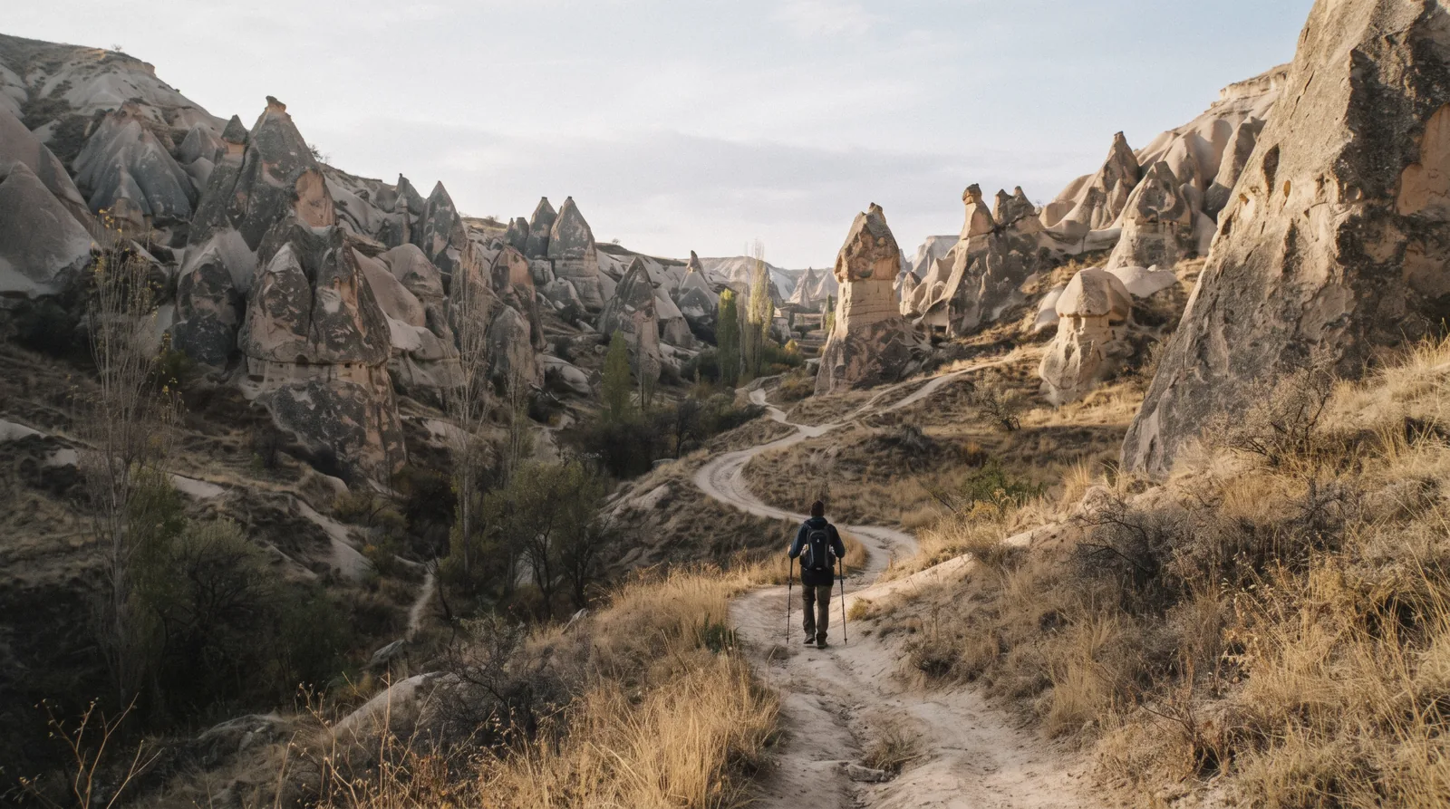
Cappadocia Valley Walks
Cappadocia valley walks start at the edge of Göreme, and the strange part is how little of the network is organised: seven valleys, every one of them free to enter, ungated and open all year, with no ticket office anywhere. Our table picks the right one for your legs and your clock, and the sections below carry the history and the practical line for each. When the plan is done, see the rest of things to do in Göreme, or start again from the guide this page belongs to.
Quick answer Seven free valleys from town, the comparison table, and the heat rule in one box.
Seven valleys are walkable straight from Göreme or its edge: Love, Rose, Red, Pigeon, Zemi, White and Meskendir, all free and open all year. The national park trails page puts the graded trails between 4.0 and 6.0 km. The one rule: start early, carry more water than seems reasonable and keep an offline map on your phone, because the junctions multiply and the signage is thin.
Key takeaways
- Compare all seven in the walks at a glance table: length, time, difficulty, best light and the trailhead to navigate to.
- If you only take one walk, make it the pink canyon with the cave churches: the Rose Valley page has the routes.
- The full-day circuit runs Love, White, Uçhisar and Pigeon in one loop: it is routed out under the two loops, with the castle at the far end.
- If the heat or the knees win, the sunset ATV ride covers the valley floor at golden hour without the kilometres.
The walks at a glance
The table compares the seven valleys a walker can start from Göreme or within a short hop of it: the graded trail length, the time our routing allows, the difficulty grade, the hour when each valley looks its best and the trailhead to navigate to. Lengths and grades come from the national park's trails page, route options such as the short Rose loop and the longer Rose-Red circuit come from the walking specialists, and where no authority publishes a figure we print that rather than guess. Everything in this table is free, checked in Q3 2026.
| Valley | Trail length | Time | Difficulty | Best light | Start from |
|---|---|---|---|---|---|
| Love Valley | 4.8 km of trail | 1-2 h one way | Easy to Moderate | Morning or golden hour | Göreme west edge or the valley road |
| Rose Valley | 5.6 km (short 2 km loop) | 1 h short loop, 2-3 h Rose-Red loop | Moderate | Last hour of daylight for the pink | Çavuşin trailhead |
| Red Valley | 5.0 km | 2-3 h with the viewpoint | Moderate | Sunset | Çavuşin side or the sunset-point car park |
| Pigeon Valley (Güvercinlik) | 4.0 km one way | 1.5-2 h one way | Easy to Moderate | Afternoon with Uçhisar ahead | Göreme edge (down) or Uçhisar (up) |
| Zemi Valley | 6.0 km | 3-4 h round trip | Moderate | Morning | Göreme south edge |
| White Valley (Bağlıdere) | No published figure | 1-2 h as a leg of the Uçhisar walk | Easy | Morning light on the white rock | Continues from Love Valley |
| Meskendir Valley | No published figure | 1 h out and back | Easy | Midday (shaded tunnels) | Göreme-Çavuşin road |
Lengths and grades are the national park's own trails figures, route options and church names come from the Cappadocia walking specialists, and times are our routing because no official timing exists for any of these trails.
One plateau, seven valleys
The valleys around Göreme are not seven separate attractions. They are cuts in the same soft rock plateau, made by the same eruptions and the same erosion, which is why they all radiate around the town and why you can link several of them into a single day on foot.
Why the valleys exist
Eruptions from volcanoes including Mount Erciyes and Mount Hasan blanketed this part of Anatolia in ash. The ash compacted into a soft rock called tuff. Harder basalt layers capped it in places, and then wind, rain and frost went to work on the rock underneath.
Because the tuff sits at different heights and hardens unevenly, erosion cut the plateau into a maze of parallel gullies and ridges rather than one big canyon, and the fairy chimneys are the leftovers where a cap protected the column below it. Göreme sits at about 1,100 m in the middle of this eroded plateau, so every valley starts a few minutes from town and the whole network radiates outward around you.
The protected frame
All of this sits inside Göreme Historical National Park, established in 1986 and, together with the Rock Sites of Cappadocia, designated a UNESCO World Heritage Site in 1985. The valleys are therefore a listed cultural landscape rather than just scenery, and the status protects the formations, the cave churches and the farmed floor of the valleys as one thing. It also explains the absence of infrastructure: the valleys are managed as open landscape, not ticketed sites, which is why none of them has a kiosk, a warden or a gate. Our Göreme National Park page covers the boundaries and what the designation includes.
The rules of a valley walk
Every valley here is free and ungated, and there are no facilities inside any of them: no water, no toilets, no food beyond the odd cafe at a trailhead. Carry water, sun protection and snacks, and treat the cafés as a bonus rather than a plan. No authority publishes an official marked-trail map or a hiking warning for these valleys, so navigation is on you: download an offline route before you set out.
Phone signal can be patchy in the deeper gullies, the junctions are maze-like, and losing the path is the single most common complaint hikers file. The heat has numbers: the average July and August high in Göreme is about 30°C over the last thirty years, against 20°C in October and 5.5°C in January. In an emergency, 112 is the national number, and the safety page carries the rest of what can go wrong.
Love Valley: the pillars
The most photographed valley in Cappadocia, and the easiest to reach from Göreme.
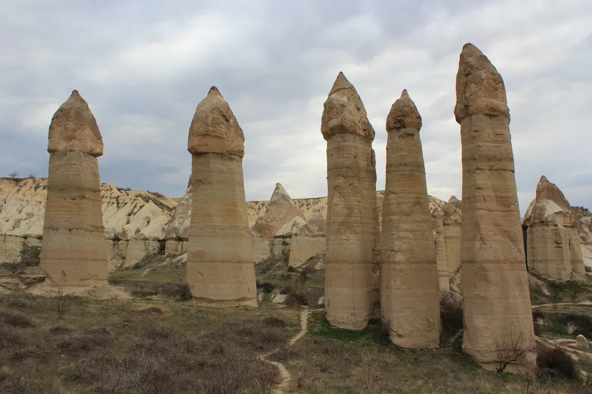
Photo: Arian Zwegers, CC BY 2.0, via Wikimedia Commons
Why it looks the way it does
Aşıklar Vadisi, the Turkish name, carries a legend of two lovers from feuding dynasties that locals attached to the valley long ago, with stones rained on the village as the punishment that became the pillars. The geology explains the shape better than the legend does. The valley floor sits under broad volcanic cliffs, and erosion left clusters of towering column-shaped formations, capped and sculpted until they look like nothing else in the region.
The name needs no further explanation once you see them. Between the pillars the floor is soft and worked, planted with vineyards and orchards, and dry washes cross the trail where rainwater cuts through after storms.
Walking it
The national park trails page puts the trail at about 4.8 km with around 152 m of elevation gain, graded Easy to Moderate, and our routing makes it 1-2 h one way if you continue on to Uçhisar. A small cafe operates in the heart of the pillars, roughly 15 minutes in, which is a rare luxury in these valleys. On flyable mornings the first balloons pass at or below the height of the column tops, and the flights themselves are the region's headline booking if you want the same view from the basket.
One trap to know: many map pins drop you at the scenic viewpoint above the valley rather than at the actual trailhead, so check where your navigation app is sending you before you leave town. Full detail, photos and the exact start points are on the Love Valley page.
Rose Valley: the pink canyon and its churches
The most colourful canyon in the park, and the one where walking and history overlap most closely.
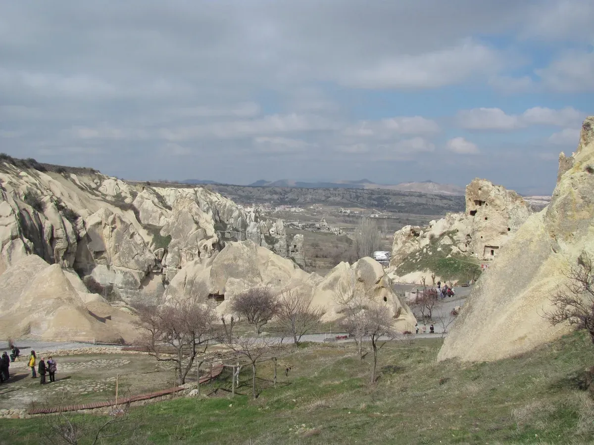
Photo: Slyronit, CC BY-SA 4.0, via Wikimedia Commons
The colour and the churches
Güllüdere takes its name from the rose-pink tint the iron-rich tuff turns in low sun. At midday the colour is muted, but in the last hour of daylight the walls glow deep rose for a stretch of about 30 to 45 minutes, which is why the valley holds the region's most celebrated sunset viewpoint. The canyon also hides some of the best-preserved rock-cut Byzantine churches in Cappadocia, cut in the 10th and 11th centuries.
Haçlı Kilise, the Church of the Cross, carries a large carved cross on its ceiling with traces of red ochre painting. Üç Haçlı Kilise, the Church of the Three Crosses, sits in a side branch with three relief crosses and fragments of Byzantine fresco on the upper walls. Both are free to enter, and both are easy to walk straight past if you do not know where to look, which is the valley's quiet joke on first-time visitors.
Walking it
The main trailhead sits at Çavuşin, a village on the Avanos road, a short drive or a long road walk from Göreme. You have two honest options. The short loop is 2 km and about an hour, walking in to Haçlı Kilise and back, mostly flat and right for a first evening.
The full Rose-Red loop runs about 5 km in 2-3 h, connecting through Red Valley and climbing out near the sunset viewpoint, and it is the most popular route in the park for good reason. There are no facilities inside the valley, so bring water, sun protection and sturdy shoes, and download your route before the signal drops in the deeper canyons. Time it for the last hour of daylight and the pink does the rest.
Route detail is on the Rose Valley page, and the village starting point is covered on our Çavuşin page.
Red Valley: the sunset valley
Photo: Ji-Elle, CC BY-SA 3.0, via Wikimedia Commons
Why sunset is the event
Kızılçukur is the valley where the rock performs. Cliffs are streaked in bands of red, orange, pink and white, and the trail threads between them through narrow gullies and short tunnels that open onto cave churches and abandoned dwellings cut into the walls. The route links old farming terraces and vineyards with panoramic overlooks, and the formations change around nearly every bend.
But the reason most people come is the light. As the sun drops, the walls glow, first pink and orange and finally deep red, and the whole amphitheatre lights up in waves. The trails page calls sunset especially spectacular here, and our routing agrees: this is the sunset valley, and the crowds at the viewpoint know it.
Walking it
The national park page lists about 5.0 km of trail with around 213 m of climb, graded Moderate, and our routing allows 2-3 h if you include the viewpoint. Two shortcuts matter. The sunset-point car park shortens the walk dramatically if you only want the light show rather than the kilometres.
And if that viewpoint feels too busy, the hill behind the cafes, topped with a flag, is the quiet version: a steep path of about 15 minutes reaches the top, and from there you look down over Red Valley, Rose Valley and all the way to Göreme, with Uçhisar on the horizon. The rock is crumbly and steep in places, so watch your footing on the descent in fading light, or accept the 20-minute walk back along the road. The full route breakdown sits on the Red Valley page.
Pigeon Valley: the pigeon farmers' valley
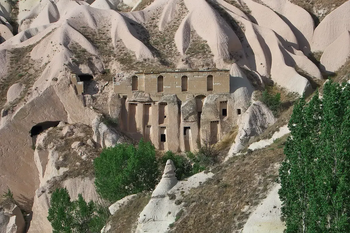
Photo: José Luis Filpo Cabana, CC BY 3.0, via Wikimedia Commons
The agricultural history under your feet
Güvercinlik, the pigeon valley, is an open-air record of an old farming economy. Thousands of niches and small houses are carved into the cliffs, built to attract pigeons to nest. Farmers collected the droppings and carried them to the vineyards and fields as fertiliser, and the manure also found its way into mortar mixes.
The practice has ended, but the pigeons stayed, and the valley still carries their name and their nests. The trail follows the valley floor past cave dwellings, orchards and patches of green, and some of the cave walls carry painted marks from the Byzantine families who lived in them, so keep your eyes on the rock as well as the path. Once you can read the niches, the whole valley becomes a walk through centuries of agriculture rather than just geology, with the rock fortress of Uçhisar ahead for most of the way.
Walking it
The trail runs 4.0 km one way between Göreme and Uçhisar with about 152 m of climb, graded Easy to Moderate, and our routing allows 1.5-2 h one way. Direction is the main decision. Walking downhill from Uçhisar puts the castle at your back and the climb behind you, which most walkers prefer.
From the Göreme edge the start is a sharp descent on a white dusty path, easy in that direction but a grind at the end of a long day in the other. It pairs naturally with the Love Valley loop, and it is the section of the big Uçhisar circuit most people remember. The full trail description is on the Pigeon Valley page.
Zemi Valley: the quiet one
Why it surprises people
Zemi is the valley the crowds skip. It runs as a winding canyon south of Göreme beneath tall volcanic cliffs, and the walking route passes fruit trees, vineyards and short tunnels, with cave dwellings and rock-cut churches set into the walls. Sections of the valley are surprisingly lush, with a wide sandy path running under trees and even a small stream in places, a contrast that catches first-time visitors expecting bare rock.
Narrow passages and the occasional scramble give it more of a hiking feel than Love or Pigeon, and the solitude is the reward: you can walk for an hour and meet almost nobody, which hikers who file reports consistently name as the reason it is the most underrated trail around Göreme.
Walking it
The trails page lists about 6.0 km with around 198 m of climb, graded Moderate, and our routing makes the round trip 3-4 h from the Göreme south edge. That makes Zemi the longest of the town-edge walks, so start in the morning, carry water for the full circuit and allow the better part of a half day. The path is mostly wide and sandy underfoot, but it is also the least signposted of the seven, so an offline map is not optional here. The map page helps you place the trailhead relative to town before you commit.
White Valley and Meskendir: the honest small print
Two short walks that round out the network, with a naming problem you should know about before you trust any map pin.
White Valley (Bağlıdere)
White Valley, called Bağlıdere in Turkish, is the stretch of whitish rock that continues from Love Valley toward Uçhisar. Many walkers treat it simply as the next stage of the Love walk rather than a separate destination, and honestly that is the most useful way to plan it: carry on from the pillars and the rock turns pale, with morning light showing the white at its best. It also makes an easy leg, roughly 1-2 h, of the full Uçhisar circuit.
Here is the honest part: no authority publishes a trail length for White Valley. Some sources conflate Bağlıdere, White Valley, Honey Valley and Love Valley into overlapping names and figures, so any kilometre count quoted online should be treated with suspicion. What is safe to plan is the continuation itself, Love to White to Uçhisar, which the walking sources all agree on.
Meskendir
Meskendir is the short shaded one, reachable from the Göreme-Çavuşin road, with a series of sandstone tunnels that are longer and higher-roofed than anything on the Love trail. Cave dwellings, carved windows and pigeon-hole walls line the route, and the path connects into the Rose and Red network, so it can be walked as a one-hour out-and-back or stitched into a longer circuit. Its practical value is timing.
Because the tunnels and trees keep it shaded, midday is the slot when Meskendir works while the open valleys bake. Like White Valley, no authority publishes its length, so plan by time rather than distance.
The naming warning
Map pins named for these valleys move between apps. The same label sits in different places depending on which navigation app you open, and some sources use two or three names for overlapping stretches of rock. The reliable approach is to choose your route by the trailheads in our table above, the Çavuşin trailhead for Rose, the Göreme south edge for Zemi, the road toward Uçhisar for Pigeon, and navigate to the trailhead rather than to the valley name.
That habit avoids the single most common mistake in Cappadocia walking, which is starting a valley walk from a pin that points at a viewpoint or a ridge with no trail access at all.
Two loops that work, and the no-walking version
Individual valleys are fine, but the best days here are loops, because loops end where they start and your transport problem disappears. These two cover the ground most visitors actually want.
The Uçhisar loop
The classic full loop runs from Göreme through Love Valley, on through White Valley to Uçhisar, up to Uçhisar Castle, and back over Pigeon Valley to Göreme. It is a long half day and the best single route in the region, because it strings together three valleys and the highest viewpoint in Cappadocia without repeating a step. Hikers who logged the full circuit put it around 11.7 km, and with photo stops and the castle visit you should plan most of a day.
Start early: there is little shade, and the Uçhisar climb is exposed. The castle itself, a Byzantine-era fortress and the highest point in Cappadocia, is covered on our Uçhisar Castle page.
The Rose-Red loop
The second loop is the afternoon version of a valley day. Start at the Çavuşin trailhead, walk the roughly 5 km circuit through Rose Valley and Red Valley, and finish at the sunset viewpoint as the cliffs light up. Our routing allows 2-3 h at a relaxed pace, which leaves room for the church stops, and if you finish on the flag hill behind the cafes you get the same light with a fraction of the crowd.
Time the start so you reach the viewpoint in the last hour of daylight, which is when both valleys perform.
The no-walking version
If time or knees rule out the trails, the valleys still come to you. The combined Red and Green day tour stops at Pigeon Valley along with the park's other sights for $21.07, which is the cheapest guided way to tick the valley scenery. For the golden hour specifically, the horseback ride from $5.72 and the jeep safari from $9.16 both run the valleys at sunrise or sunset and get you the views without the kilometres.
Rides through the valleys, for the golden hour
On a short trip, an hour riding the valley floor at golden hour beats skipping the valleys entirely. These four cover the options, from saddles to quad bikes to a jeep with champagne. Prices and ratings are the booking platform's own listings.
 from $29.57
Cappadocia:Göreme ATV Sunset or Daytime Tour
Two hours of dust and valleys to Rose Valley or Sword Valley at sunset, with a guide leading the convoy. No licence needed, big grins standard.
Check Availability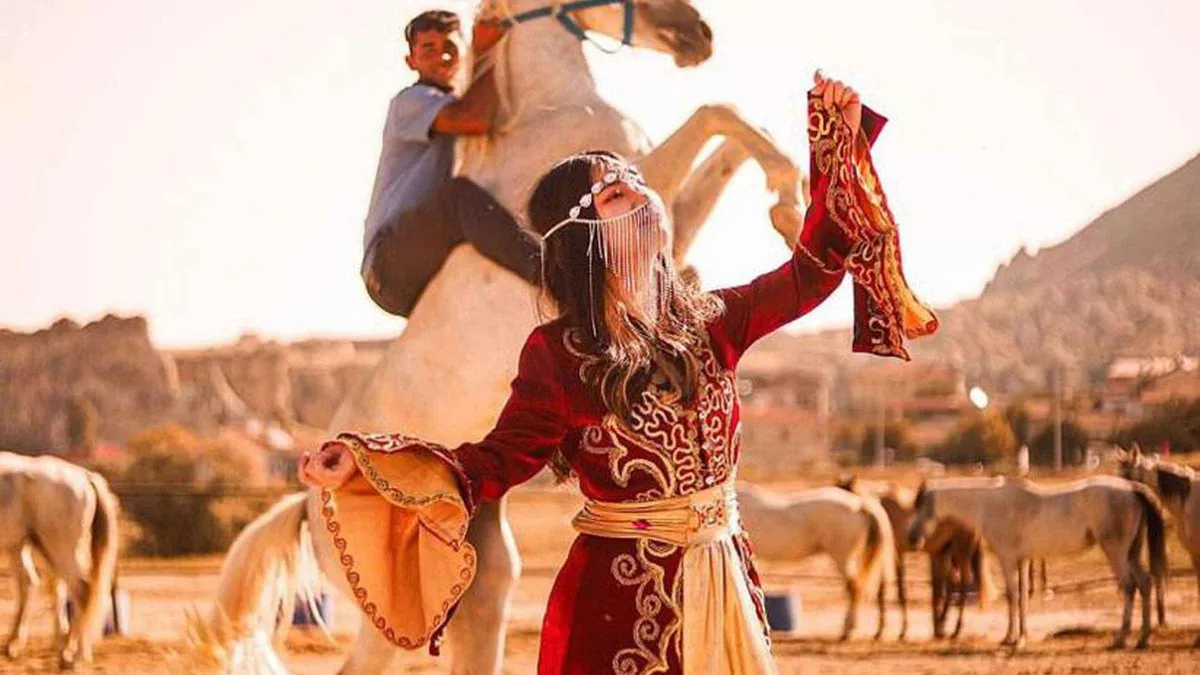 from $5.72
Cappadocia: Horseback Tour with Sunrise and Sunset Options
The ranch country version of sunset: an hour or two on calm horses through Love Valley's columns, sunrise or sunset slots, transfers included.
Check Availability from $9.16
Cappadocia: 2-Hour Jeep Safari at Sunrise & Sunset Views 4x4
A two-hour open-jeep loop through the valleys at sunrise or sunset, camera-friendly stops built in, pickup from your hotel.
Check Availability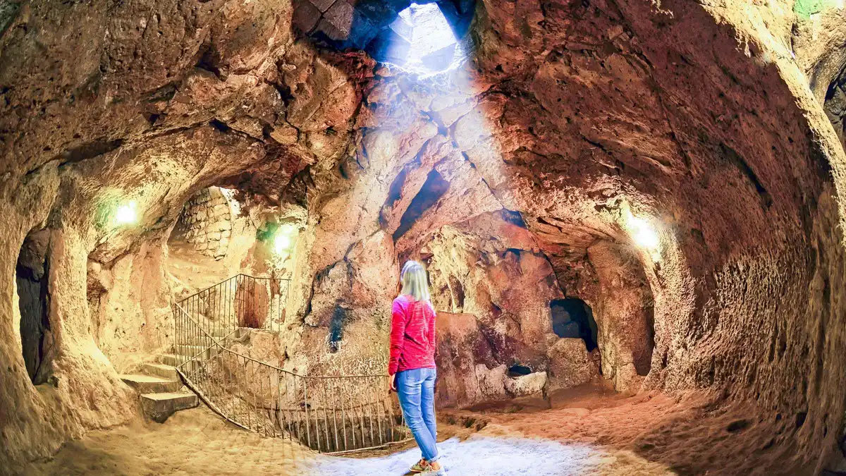 from $21.07
Full Day Cappadocia Red and Green Combined Day Tour
The whole classic loop in one day: the north valleys, the Open Air Museum side, then the underground city and Ihlara on the green half. Entry tickets are extra.
Check AvailabilityPrices, ratings and details are the platform's own. dollar figures are the listed prices — the platform bills in your account's currency.
Route on from the valleys
Love Valley
The single-valley detail: trailheads, the cafe in the pillars and the map-pin trap explained in full. Love Valley, valley by valley.
FreeGöreme Sunset Point
The in-town viewpoint for the evenings you would rather not climb a valley ridge. Göreme Sunset Point.
Town edgeUçhisar Castle
The fortress that anchors the far end of the Pigeon Valley trail and the big loop. Uçhisar Castle.
End of the loopWhen to go
The months when valley walking is comfortable rather than a heat test. Best time to visit Cappadocia.
April-June, September-OctoberCappadocia valley walk questions
What are some good walks in Cappadocia?
Seven valleys start at or near Göreme: Love, Rose, Red, Pigeon, Zemi, White and Meskendir, all free and all walkable without a guide. Compare them in the walks at a glance table above, which lists lengths from the national park trails page and the best light for each.
Which valley is best in Cappadocia?
For most visitors, Rose Valley, because it combines the pink rock, two Byzantine cave churches and the best sunset viewpoint in the region. If you want solitude instead, Zemi is the quiet one, and if you want the shortest walk from your hotel door, Love. The Rose Valley page covers the routes and the churches.
Is it possible to walk to Love Valley from Göreme?
Yes, and it is the normal way to arrive. The trailhead sits at Göreme's west edge, and the trail runs about 4.8 km graded Easy to Moderate. Watch for map pins that drop you at the viewpoint above the valley instead of the trailhead: the Love Valley page marks the difference before you set out.
How long does it take to walk the Lycian Way?
The Lycian Way is a different trail entirely: a long-distance route in southwest Turkey running from near Fethiye to near Antalya, waymarked red-and-white and opened in 1999. It runs for hundreds of kilometres and takes weeks, so it has nothing to do with Cappadocia. The walking here is half-day valley routes that start at Göreme's edge, inside the national park.
Do I need a guide for the valley walks?
No. The valleys are free, ungated and walkable independently, and most hikers do them alone with a downloaded offline route. Signage is thin and junctions multiply, so navigation is the one skill you need. The safety page covers the practical pitfalls.
What should I bring on a Cappadocia valley walk?
Water above all, because there are no facilities inside the valleys. Add sun protection, sturdy shoes, snacks and an offline map, and keep a little cash for the cafes that appear at a couple of the trailheads. The Göreme costs page puts that in context.
When is the best time of year for walking in Cappadocia?
April to June and September to October are the comfortable walking months, with average highs between about 17 and 26°C. In the summer heat start before 10:00 and favour shaded Meskendir at midday. The month-by-month breakdown is on the best time to visit page.
The valleys on video
Three walks filmed on the ground, so you can see what the trails actually look like before you pick one.
Six hikes across Cappadocia, filmed on the trails
A compilation covering several of the valleys in our table, useful for seeing how the terrain changes between Love, Rose and the quieter routes.
Video: World Wild HeartsWalking Love Valley, Rose Valley and Göreme
A hiker's route through two of the seven valleys in this guide, showing the pillars and the pink canyon back to back.
Video: Jonny Boy WanderExploring Göreme and hiking Love Valley
A walk from town out to Love Valley, handy for seeing how short the link from Göreme's edge to the trailhead really is.
Video: Tania - Travel StoriesThird-party videos, embedded without cookies. Neither the channels nor the videos are connected to this site.
Prices, hours and terms are set by the venue or operator and confirmed at checkout.
We may earn a commission if you book through one of our links, at no extra cost to you. Full affiliate disclosure